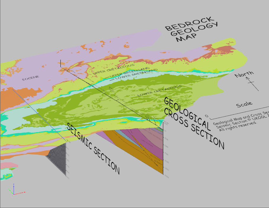
It is important to remember that a single seismic profile is only one line across an area that is really three dimensional.
To help you visualize the ‘big picture’ when you activate the 3D model, it may be helpful to think about the following:
- the relationship of seismic data to the familiar solid geology displayed on geological maps
- compare the structures on the geological cross-section with those on the seismic profile
The 3D model can be rotated, zoomed and lit from different angles.

Download this PDF to view the 3D model (right-click, select Save-As, then open the downloaded file in an external PDF viewer such as Adobe Reader. Your built-in browser PDF viewer will not display this PDF correctly as it contains an interactive 3D model).


